Map in Seconds is a very useful web application that enables you to create any data representation on world map. While representing statistical and geographical data, we often need maps to plot data visually. For e.g. plotting population on world map, weather, climate, natural vegetation or any such data, we often plot them on maps. Now there are several software application that can serve this purpose but if you are doing school or college projects and you need simple user friendly application to perform the functions which can not be done easily with Excel of Google Docs. The name of the software is Maps in Seconds. Maps in seconds help users to create worldwide maps for various purposes in a jiffy. It lets you paste data from a spreadsheet and maps it for you. The app can create worldwide maps and even smaller region based ones.

Steps to chart data on a world Map with the help of Map in Seconds
1. Collect and jot down your data in Open Excel or Google Spreadsheets. Now arrange the data in two columns so that the can be plotted in the maps. One column should be for geographical region and the other one should be for the data itself. The software is spelling sensitive. So if you spell any region or country wrong, then the application won’t be able to plot the maps correctly. In addition to that, don’t group countries into trade regions e.g. EU.
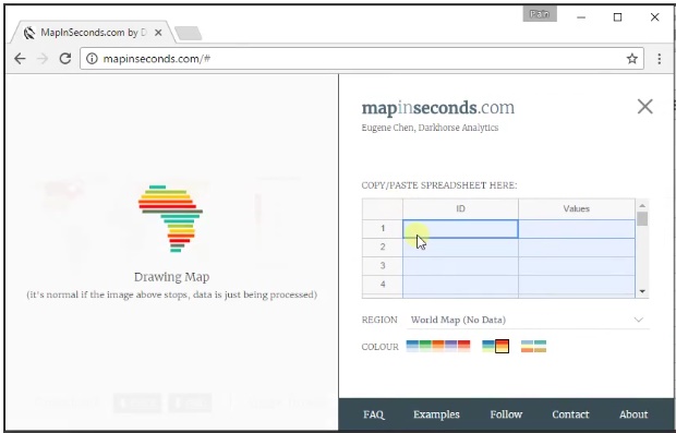
2. Now open MapinSeconds.
3. The Map in Seconds also has a spreadsheet of its own. Copy and paste our data in the application’s spreadsheet. The map is highly interactive and can create maps in just few seconds. When you hover your mouse over a country or region, it shows you the data associated with it.
The application is very useful but it becomes slow at times. It can be customized to a good extent, i.e. the color tones can be changed to green, red, orange, purple, and even black. You can also make the map more colorful with countries differentiated by color instead of shades of a single color.
It does not support PNG and PPTX files. If you want to keep the map interactive, share a link to it.